Water, Weather and Environment
Increase your resilience to challenges in water, weather & the environment with tools specific to your needs

Market-leading sensors, software and turnkey solutions
With a full workload, the ability to collect and manage all the data you need (and want) for analysis, reporting, decision-making and publishing can be a heavy task. We develop reliable sensors and comprehensive software to relieve the burden.
When you need more time and bandwidth to solve big problems, our tools help you measure what’s going on with water, environment, and weather; explore your data; and reveal insights for decisions important to you and your community.
Whether you’re an expert, generalist, or senior decision-maker, you ensure you get data you need. Plus, you have options to share data, intuitive images and dashboard across your organization, with stakeholders outside your organization, and the general public.
Browse the sensor catalog
Our expertise in the water, weather & environment sector
Surface water, Groundwater, Irrigation and Hydrology
Measure and report the health of lakes, streams, rivers, aquifers and watersheds
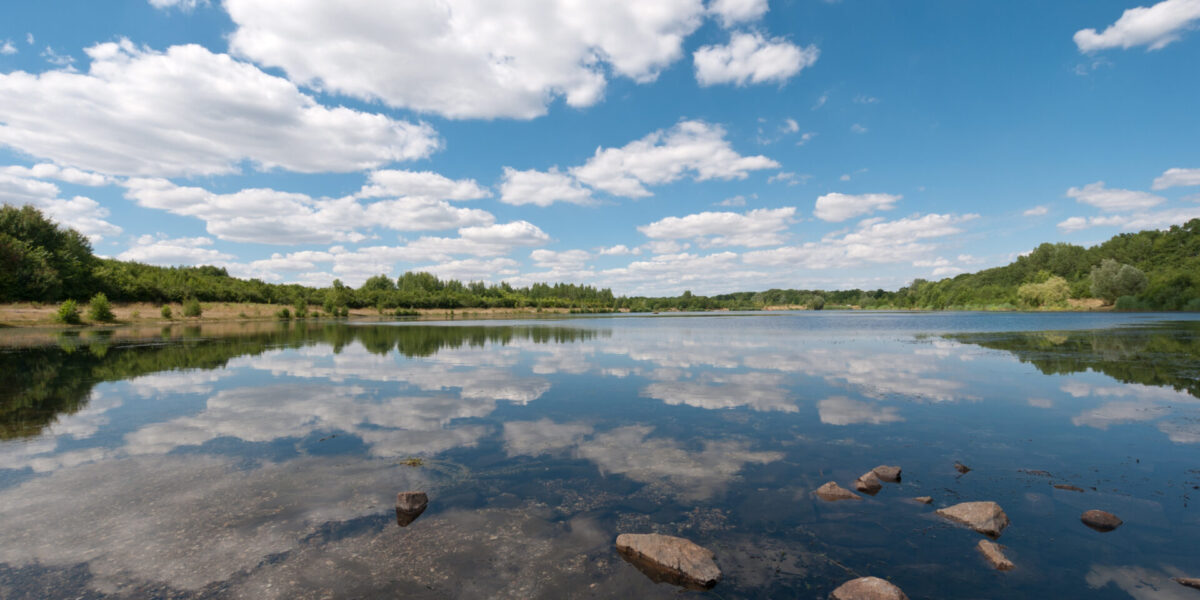
Surface water, Groundwater, Irrigation and Hydrology
As water moves within the atmosphere and earth, precipitation impacts water levels above ground in lakes, streams, rivers and reservoirs, as well as below ground in aquifers. Measuring water levels helps sustain clean drinking water supplies, manage flood risk, and identify conservation and development opportunities. Historical and current data must be available for short- and long-range forecasts that inform and affect quality of life.
What we do
We’ve been developing hydrological software for 40 years to help customers become more data-driven and self-reliant. Today our wider array of IT solutions and monitoring sensors continue to create value in the hydrological data workflow. Unlock the power of your data with software configured to your specific needs, so you can recover time and focus on analyzing information for appropriate actions & plans.
Who we are
Our global workforce includes software developers, programmers, engineers and information security experts in addition to the original environmental and water resource engineering experts.
We understand present and emerging IT capabilities and the science of water, in order to develop tools that build our customers’ technical capacity and overcome data management obstacles. We help you develop a comprehensive understanding of your water, weather and environmental data.
Our team also includes designers and producers of sensors that accurately measure water levels and flows. Many have extensive in-field know-how from previous work as hydrologists, hydrographers and hydrologic technicians. Consistent with our value to prevent vendor lock-in, our equipment enables any qualified technician to test and/or perform maintenance on it.
Practical experience combined with skilled engineering and production offer you sensors, telemetry systems, or a turnkey data collection and management system – which will import data from all brands of monitoring devices.
Water quality & Ecology
Plan, sample, review and report on water quality and ecological data from the field or lab

Water quality & Ecology
Monitoring watershed health isn’t limited to measuring water levels. Water quality monitoring programs and ecological assessments also reveal environmental health through water chemistry lab results and biotic indices. Unlike real-time continuous monitoring data, discrete sampling events or point-in-time organism counts require a different approach to metadata and data management. However, these datasets shouldn’t go unused because you lack IT tools to do multi-disciplinary analysis or even view all your data together.
What we do
For more than a decade, we’ve been developing software to store, manage and make non=continuous datasets available with continuous datasets. As users within your agency have the ease to discover, retrieve, view, analyze, report and share information, you can develop a holistic view of your area of study.
In addition, flexible web services and web portals give you options to publish quality-assured information to enhance public education.
Who we are
We work closely with customers like you and listen attentively to your data needs. When water quality managers told their hydrology peers they wanted similar long-term data management capabilities and self-sufficiency to manage extensively amounts of metadata, we funded R&D as well as recruited water quality specialists and biologists to ensure our water quality and ecology software is designed by experts for experts. (A volunteer monitoring data solution is coming soon…)
Today the North American water quality community of practice is growing fast as local, state and federal governments use the software to investigate soil and water quality.
We strongly believe that managing good data begins with collecting good data. We have selectively partnered to provide precision water quality sensors for continuous or discrete monitoring. In addition, we have chosen devices with low-maintenance demands and costs — so you can focus on the accompanying water quality and ecology tasks fitting for your watershed management.
Specialized knowledge and monitoring innovations offer you sensors, in-field survey applications, or a turnkey data collection and management system – which will import data from all brands of water quality probes.
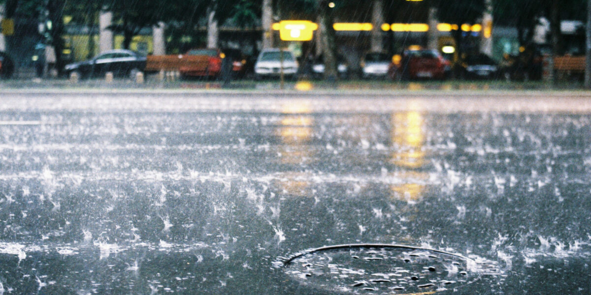
Meteorology & Climatology
Prioritize operations and protect assets and lives as you monitor current and future local weather

Meteorology & Climatology
Weather data are critical for operations, planning and continuity. Collecting data — and the most accurate data — has become more important as storm events have become more unpredictable. Future storm events and their drainage can no longer be assumed to be static. Forecasts as well as current and historical data must be available for decision-makers regardless of file formats and timesteps they’re collected in.
What we do
Our holistic view of data management, from collection and processing to presentation and dissemination, meets the high demands of applied meteorology and climatology. Our commitment to accuracy, precision and value-added processing increases the confidence level of your data and access to information for real-time decisions and long-term plans.
Who we are
Our team of meteorologists and engineers are familiar with the details of measuring air temperature, relative humidity, wind, precipitation (rain, snow and even hail), and other weather parameters. Thousands of meteorological sensors deployed worldwide continue to refine their design, production and installation expertise. Lean into decades of our knowledge to provide a solution that meets your needs or preferences.
Our meteorological data experts have agency experience, previously working as data and IT users in operational settings. They know collection and processing protocols in addition to presenting and reporting information for the meteorological community, collaborators, and the public. These insights are incorporated into our data visualization, data management software and operational technologies.
Be assured that data you chose to present, report or share, passes scientific and operational standards.
Rainfall and Flow Forecasting and Warning
Lessen risks at hotspots or catchments with accurate rainfall, water level & flow data and forecasts
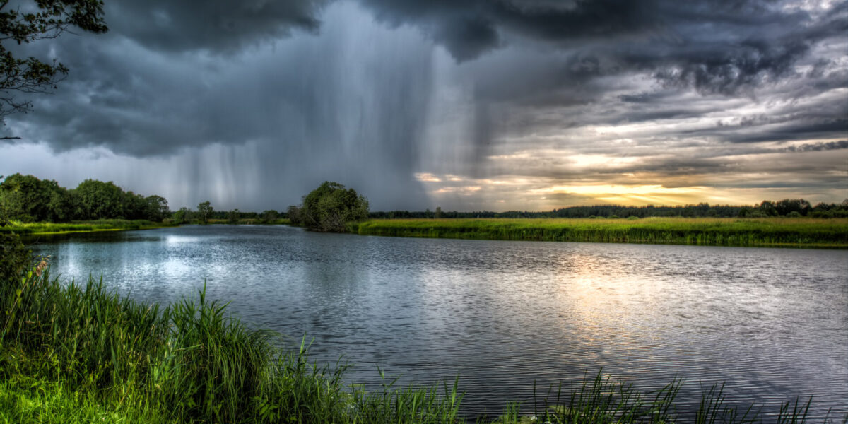
Rainfall and Flow Forecasting and Warning
All of us have experienced or heard news about more extreme weather events, from heavier rainfall during the wet season to changing months that define the wet season. Likewise, droughts are becoming more severe and increasing flooding risk. Water and emergency management professionals can lessen the risks of these hazards using rainfall, flow, and flood forecasts. Data can alert public safety agencies of imminent threats and provide actionable information to help officials determine if, when and where public warnings and evacuations may be advised or mandatory.
What we do
Uncertainty is inherent to forecasts, or estimates from models that imitate reality and its complexities. Instead of banking on a single forecast, we use ensemble forecasting to provide valuable information to decision-makers and with as much lead time as possible before an impending event. The range of possible future scenarios helps agencies manage expectations, act proactively, and seek additional resources if needed. Our unique seat at the intersection of hydrometeorology and data management ensures you have reliable information and robust IT networks that allow you to concentrate on prevention, response and recovery.
Who we are
Our water resources engineers, hydrologists, modelers and data scientists listen to your forecasting needs. We work closely with you to identify the rich array of private and public data sources. (Additional commercial data sources may be considered to address data gaps or increase forecast accuracy.)
Then we configure and integrate these data into a wide variety of hydrological, reservoir operations, basin management and hydraulic models in our technology stack. We confirm the forecasts and couple them with features, such as customized alerts & dashboards, to empower your team performing O&M, making power generation schedules, or managing water storage ahead of prolonged drought conditions.
Forecasts are only as good as their data inputs. Our team also includes designers and producers of sensors that accurately measure precipitation, water levels, and flows. The extensive in-house knowledge and close working relationships with flood control districts, electric utilities, and the USGS make certain you collect accurate and precise data. Our forecasting skills enhance the end-to-end data collection and management system.
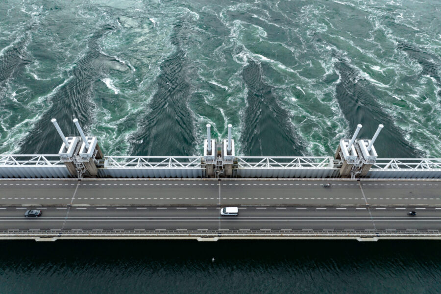
Hydropower, Dams & Reservoirs
Optimize power generation, water & revenue; also measure dam safety & meet regulatory constraints

Hydropower, Dams & Reservoirs
Surface water reservoirs represent multi-benefit water infrastructure for water resource management. They store water supply, protect against flooding and attract tourists to recreational areas. When stored water is released through dams, hydropower is generated — moving communities away from reliance on fossil fuels.
What we do
Like reservoirs, our data management systems enable you to store a large volume and variety of data to sustain dam safety, power generation, and clean water quality for native wildlife, residents and visiting tourists alike. Our commitment to high-quality data and efficient access to transformative data lessens the uncertainty and risks associated with aging infrastructure and intensifying storms. We configure and support our off-the-shelf software to your needs, saving you time from the development of completely customized software and enabling you to share information with other working groups as needed.
In addition, we offer optional enhancements: A high-resolution, extremely precise raster rainfall forecasts to inform generation and maintenance activities. And an intuitive web platform for hydro operators to define challenges, prioritize goals, and identify the best possible schedules to maximize water supply and hydropower generation.
Besides managing continuous hydromet and dam safety data, we offer non-continuous water quality and ecology software to power biologists who help balance electricity generation with environmental protection.
Who we are
In addition to hydrologists and water resource engineers, we are data scientists and mathematicians who love optimization who have developed algorithms for a range of applications. We are privileged to help optimize green infrastructure to lessen sewer overflows while promoting urban biodiversity, as well as to help dam operators adjust to greater climate variability. We apply this practical knowledge to further develop our solutions to provide actionable information and guidance both to decision makers and dam operators.
We are also water quality specialists and biologists who help bridge the continuous and discrete data divide skillfully. We help the diversity of electricity utility working groups to share information as well as to improve collaboration and communication with scientific and non-scientific community members.
We recognize that one size doesn’t fit all, but we have the knowledge and solutions — from sensors and telemetry systems to data services to a turnkey data management and forecasting system – to help overcome obstacles to unleashing the potential of your hydropower, dam and reservoir management data.
Drinking water, Sewage and Wastewater
Achieve compliance & outcomes as you monitor, analyze & report on water treatment operations
Drinking water, Sewage and Wastewater
To sustain clean water services, water utilities are diversifying water sources and investing in water infrastructure, especially with new financial support from federal governments. Additionally, attracting and retaining skilled labor is essential to service delivery, business continuity, public health and emergency preparedness as an aging workforce retires. Collaboration, public education, and technology are raising awareness of the value of water and helping utility management solve major challenges.
What we do
We equip you with advanced tools to provide acute situational awareness as well as comprehensive data management software to forecast & sustain safe water supplies. Our commitment to accuracy, precision and value-added processing increases the confidence level of your data, especially as compliance officers report to regulatory agencies and operations managers identify continuous improvements.
Our IT system commonly coordinates large masses of data from SCADA systems, historians, analytical lab results, and effluent monitoring systems, to name a few. The system can scale with expanding operations, making it a popular solution among cities and counties where subdivisions multiply and people keep moving in.
In addition to hardening cybersecurity, our water utility IT solution offers several automation options. Mobile device web applications enable operators to accurately collect data, minimizing errors from paper-based processes. Advanced data validation and analytics coupled with alert settings enable staff across your enterprise to focus on priorities and avoid distractions from the large majority of acceptable data. The same features can be used to estimate unmeasured data and notify appropriate team members to operational inefficiencies such as potential water losses and unnecessary pumping costs. The information equips you to navigate toward operational and financial goals.
Who are we
Our hydrologists and water resource engineers have been working with utilities who protect source water, provide drainage services, and perform wastewater treatment for many years. In particular, we’ve helped them ease data management as water moves in and out of collection systems.
Three of the top five metro areas in the U.S. rely on this technology which meets the demands of the U.S. Homeland Security’s Water Security Initiative.
Our global workforce also includes software developers, programmers, engineers and information security experts, so we understand the value of integrating our information with business intelligence platforms. Customers have much to gain as IT unlocks opportunities and exposes vulnerabilities hiding in the operational data of your water system.
Paper Chart Digitization
End storage costs & put validated historical data to work as we digitize paper charts

Paper Chart Digitization
Collecting weather and water level data isn’t new. Today many electronic monitoring devices help us complete this task more easily, but past data collection efforts are literally collecting dust and racking up storage fees. Plus, paper charts can offer valuable insights about trends about seasons, climate, and flooding hotspots in particular.
What we do
Our digitization service converts your analog data into modern digital data, which can enrich your present data analysis and even forecasting efforts.
Delegate chart scanning and data identification to us. We’ve selected partners with expertise in scanning large quantities of water level charts. We’ll work with them to convert the data entries, water level graphs for example, from paper format into properly referenced digital images. Then we use artificial intelligence to identify data in these images along with any notes taken at the time.
In addition, we facilitate data validation and data management. Our well-developed quality assurance tools and data scientists validate your digitized dataset. Much of this phase is done automatically, but manual validation is also performed to ensure high quality data are transferred to your data management system — and ready for your consideration and use.
Who we are
Unlike other technology companies, our origins and core competency are anchored in water resource engineering. We understand the science of water and provide tools that overcome data management obstacles.
Our team has extensive in-field know-how from previous work as hydrologists, hydrographers and hydrologic technicians. We’re committed to helping you to maximize the availability of accurate water levels and water flow measurements.
You focus time & efforts to develop a comprehensive understanding of your water data.
Our products & services
Latest news
see all
Webinar to explain radar hydrology & invite Q&A
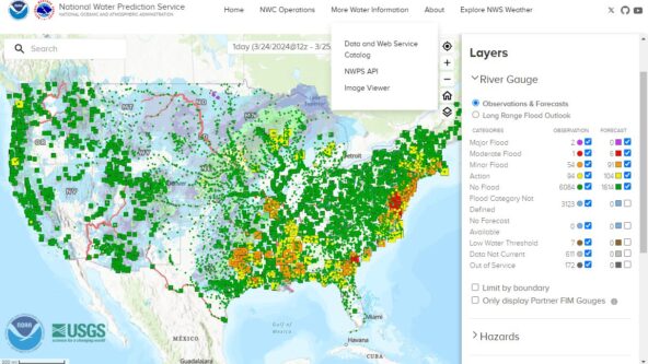
New NOAA website centralizes water data & forecasts
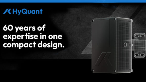
KISTERS launches HyQuant, compact non-contact water radar sensors at accessible price
Upcoming events
22 - April 25, 2024
Corvallis, OR
Western Snow Conference
23 - April 25, 2024
Tuscaloosa, Alabama, USA
Water Observing Technology Forum
14 - May 15, 2024
Houston, TX, USA