Minimizing storm-related impacts on infrastructure and assets
November 5, 2019
HydroMaster radar rainfall data service is now live in Canada; the software as a service (SaaS) helps minimize storm-related impacts on infrastructure and assets.
Extreme precipitation events and flash floods are increasing in frequency and severity across the globe with climate projections indicating a likely continuation into the future. Canada too is struggling to manage the consequences of heavy rains, floods, and hurricanes.
Using the web-browser interface or APIs to deliver data as a service (Daas), Canadian authorities, cities, infrastructure stakeholders and emergency responders better prepare for extreme weather events and become better informed during storm events.
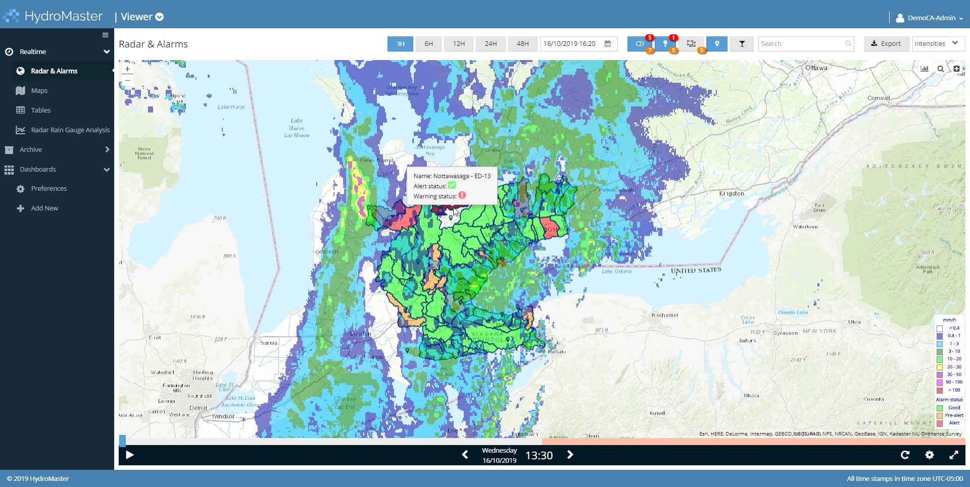
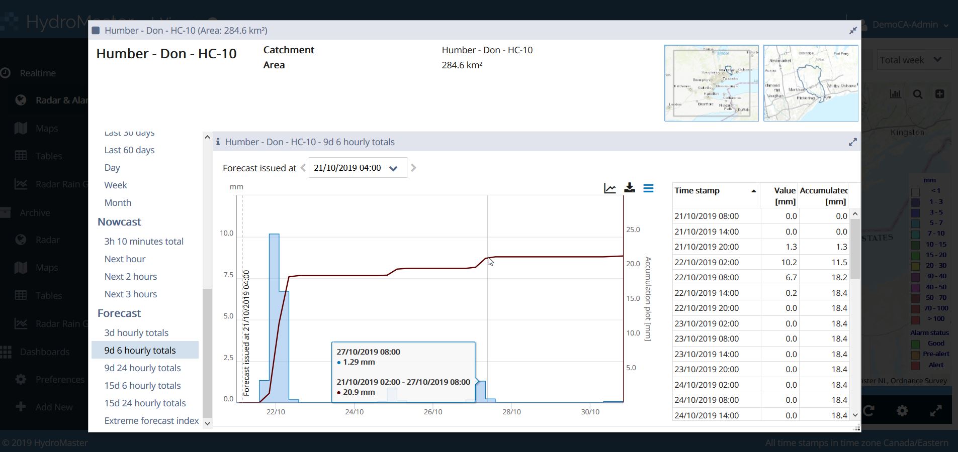
High-resolution display and analysis of real-time and forecasted weather data are integrated with critical infrastructure data and mapping – empowering stakeholders to quickly identify the formation of very sudden and localized events, anticipate potential problems, and dig deeper into the relevant data for rapid and informed decision making and response.
Advanced alert settings enable color-coding of watersheds and subwatersheds as risks of localized flooding escalate from green to yellow-orange to red, and SMS (texts) and/or emails are set to groups and/or individuals on duty.
As a secure service hosted at an ISO-certified data center and available 24/7, HydroMaster is accessible from a variety of desktop and mobile platforms and is less susceptible to power outages during extreme events. It eliminates extra costs associated with software installation and updates, as well as IT hardware.
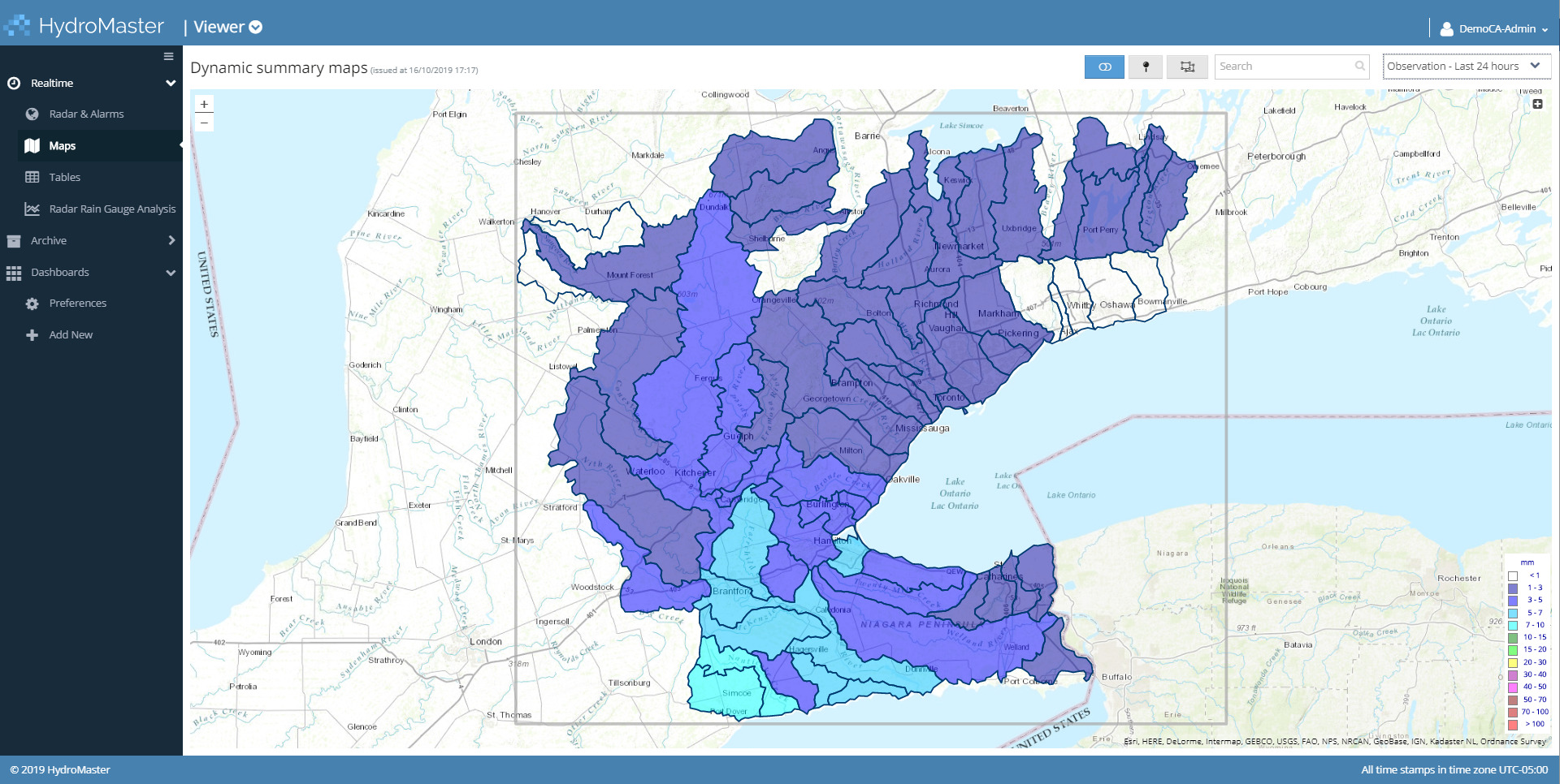
The cloud service shows real time precipitation observations and forecasts via web browser.
High resolution precipitation observations and forecasts over user-defined areas are as granular as 1 sq km.
Several European countries have proven HydroMaster’s advantage, particularly at the municipal level, among water utilities and even transportation service providers like railways.
Local information, forecasts, and warnings for individual hotspots and catchments are based on a one-square-kilometer-resolution – proving much more useful than coarse large-scale data sets.
Expert features for all levels of users
 HydroMaster was designed with insight from meteorology, hydrology and IT industry leaders
to bring the following features to all levels of users:
- Weather data and forecasts
- Hydrological and hydraulic models
- Data integration and analytics
Hydromaster empowers users with analytics, capabilities to define exceedance thresholds and alerts / warnings, and several data visualization options.
Coping with climate variability
Extreme and highly localized weather events are appearing more frequently and heavily due to increased urbanization, population growth and climate change. They pose a direct threat to life, health, infrastructure, production and assets. Consequently, stakeholders in civil protection and the supply industry require increased awareness of future precipitation events, in order to adjust their decision-making and actions to deal with potential impacts of climate change.