Water, Weather & Environment
Initiating AI flow data collection to better forecast flood risk
Flood control district improves flood forecasting as risk of flooding increases
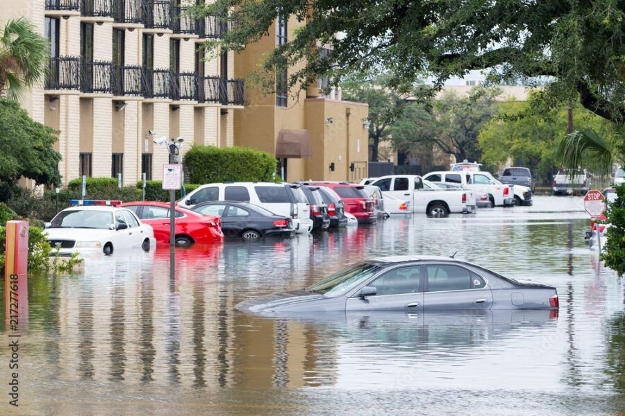
Surrounding the Houston, Texas metropolitan area, Harris County experiences a major flood approximately every two years. Population growth has put its rapidly expanding urban and suburban areas at increased risk for flood events due to changing weather patterns. Despite flood damage reduction projects, these natural disasters have made Harris County the number one flood insurance funds purchaser of all communities that participate in the federal National Flood Insurance Program (NFIP).
- The challenge
- The solution
- The benefits
The challenge
The challenge
Harris County Flood Control District had historically identified flood threats using simple water level and rainfall sensors. While these sensors can be used to develop a stage / discharge rating, they require manual measurements to be carried out at every site using mechanical or acoustic current meters over a period of 1 to 2 years or longer. This process has been the industry standard for decades. While effective, this process is complex, time-consuming, and very expensive.
The solution
The solution
The district identified an innovation that would enable it to continuously measure water level and velocity. Once installed, the RQ-30 radar discharge sensor provides real-time level, velocity, and flow/discharge data. County staff and city partners took the opportunity to retrofit existing monitoring stations and expand the number of stations in the region’s flood warning network.
From 2019 to 2020, Harris County Flood Control District deployed 54 next generation non-contact radar discharge sensors into its existing flood warning network. Using non-contact pulse and Doppler radar technology, the sensors deliver continuous real-time water level, velocity and discharge data — and provide new insights into forecasting of flood events specific to the region.
In real-time, the RQ-30 detects parameters and calculates the flow/discharge data using machine learning, then each unit wirelessly transmits data to data management system for further processing and published online for on-duty staff to view, analyze and take action as necessary.
The benefits
The benefits
Harris County Flood Control District and emergency management partners have better situational awareness and forecasting capabilities to increase public safety, now and into the future as climate patterns continue to change.
The ability to collect more accurate and more current data at more locations has increased access to real-time stream conditions and improved flood forecasting efforts. The artificial intelligence (AI) in the sensors adapt to the distinct conditions of each monitoring site, saving district staff time from correcting or re-shifting data.
The data collected supports flood forecast model calibration. The post-event information is reviewed and aggregated with flood forecast models, helping the county to better anticipate where flooding will occur in the future.
District staff have a safer and more timely means of collecting flow data.
Measurement using a contact-free method allows district staff to mount sensors on bridges or extension arms. The placement of the devices increases the safety of district staff who have typically used mechanical or acoustic current meters in or around the channel or river. Furthermore, the automated measurement and transmission of water data allows staff to recoup time and reallocate it to higher priorities.
The district achieves lower maintenance costs.
To bolster confidence in the data collected, the sensors self-check with a status and error report. If any change to the sensors is required, district staff can access them remotely for all configuration and data acquisition needs. The sensors are also low power and solar-ready to maximize usage in the field before requiring maintenance.
District staff can better inform residents.
The enhanced data collection benefits the community at large by giving residents access to flood forecast insights through the same flood warning system already in use to view flood risk and predictions.